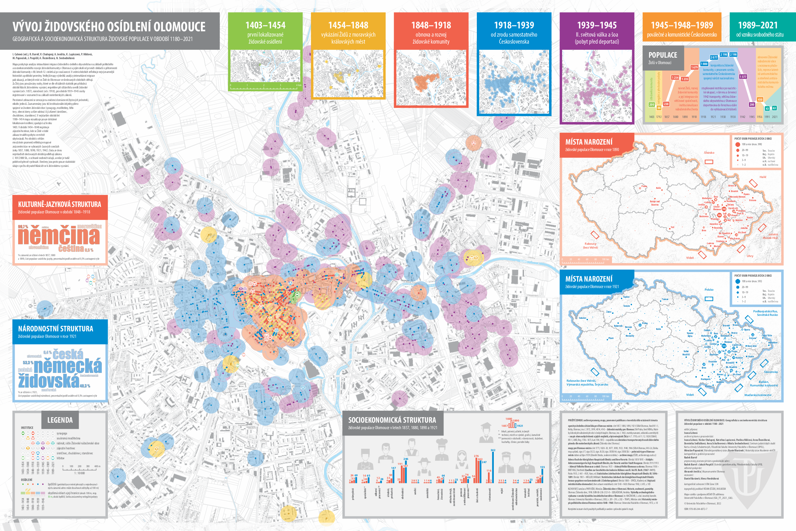
Specialized map: Development of the Jewish settlement in Olomouc

Development of the Jewish settlement in Olomouc:

Geographical and socio-economic structure of the Jewish population in the period 1180–2021

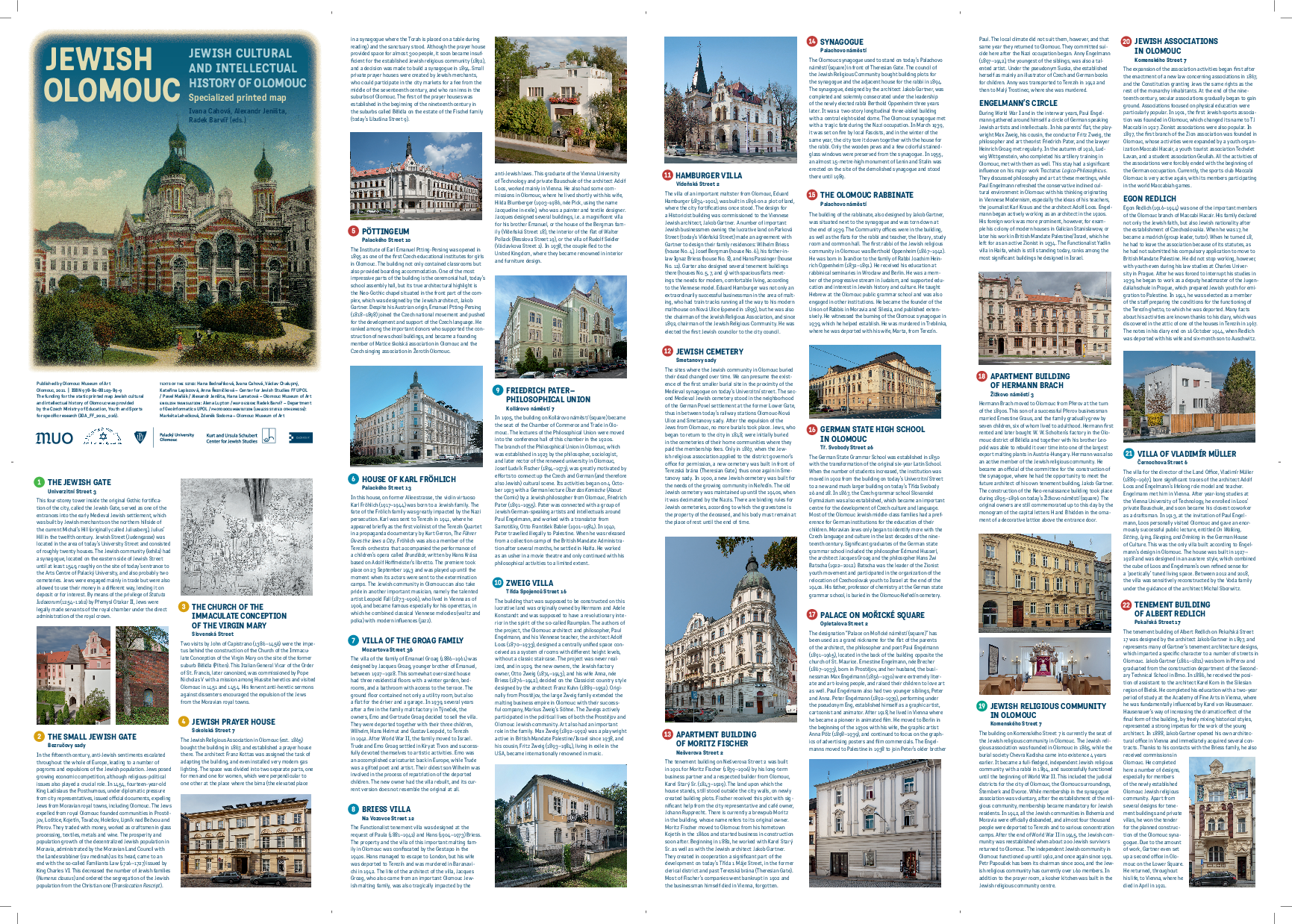
Jewish Olomouc:

Jewish cultural and intellectual history of Olomouce

The map can be downloaded in an interactive form to your smartphone for free in the ACTIONBOUND application. Subsequently, it is necessary to search for BOUND "Jewish Olomouc" and start the application. The application can be used either as an interactive guide, or the entire circuit can go through a competitive form of the so-called urban game and search for individual locations on the principle of geocatching.
Privacy settings

We use cookies and any other network identifiers on our website that may contain personal data (e.g. about how you browse our website). We and some of the service providers we use have access to or store this data on your device. This data helps us to operate and improve our services. For some purposes, your consent is required to process data collected in this way. You can change or revoke your consent at any time (see the link at the bottom the page).

(Essential cookies enable basic functions and are necessary for the website to function properly.)
(Statistics cookies collect information anonymously. This information helps us to understand how our visitors use our website.)
(They are designed for promotional purposes, measuring the success of promotional campaigns, etc.)